Food Security
- Triton Food Pantry
- Food Recovery Network
- CalFresh
- Yes! Food
- iTable
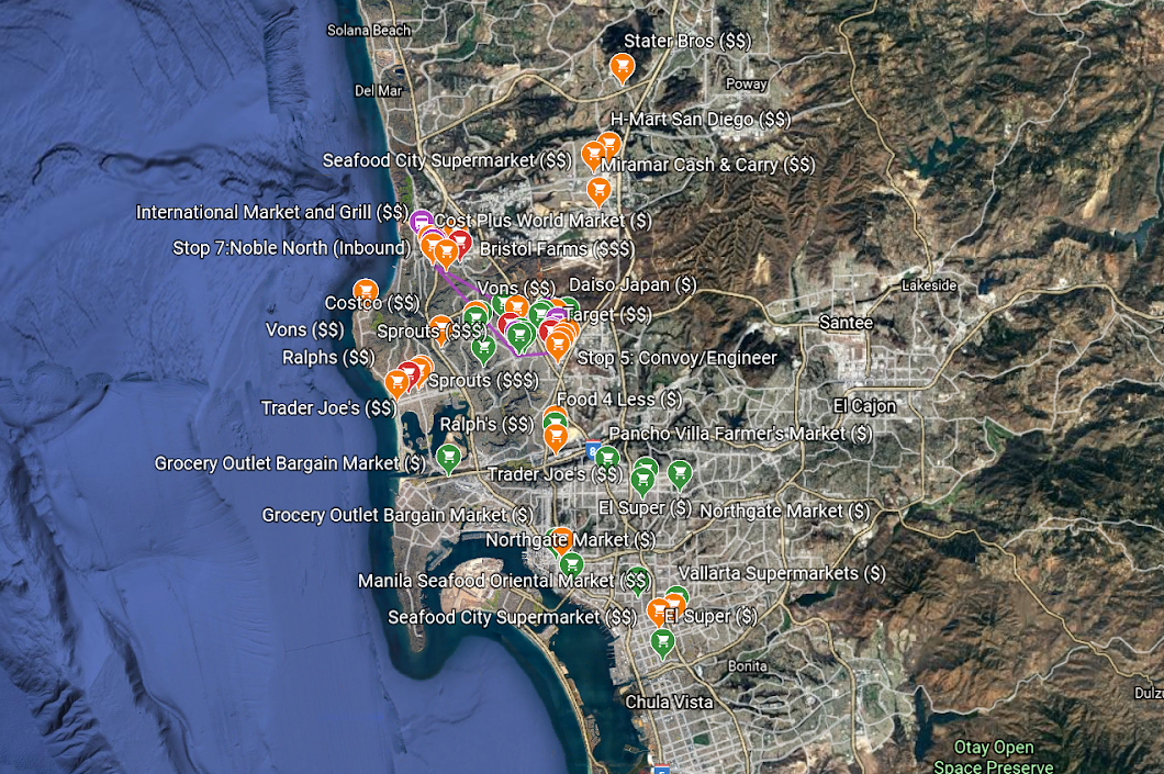
- Affordable Grocery Store Map
- Grocery Shuttle
The Affordable Grocery Map service was a result of two students' advocacy, Josh & Apollo, through their experience of being houseless students while at UCSD! Josh created the affordable grocery map on an excel sheet that showcased the cost of local culturally reflective grocery stores from UCSD based on affordability during Summer 2018! They yelped reviewed the locations, identified time frames to get to the grocery store, and more!
We thank Josh & Apollo for their leadership because their advocacy led to the creation of what we know the affordable grocery map to be today!
This map shows various grocery stores in San Diego. They are color-coded to represent their cost ($=green, $$=orange, $$$=red). All estimated times of arrival (ETA) are from the Gilman Transit Center. This map also includes the shuttle stops for the Grocery Shuttle. Click on the map image to open Google Earth and view more details.